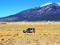
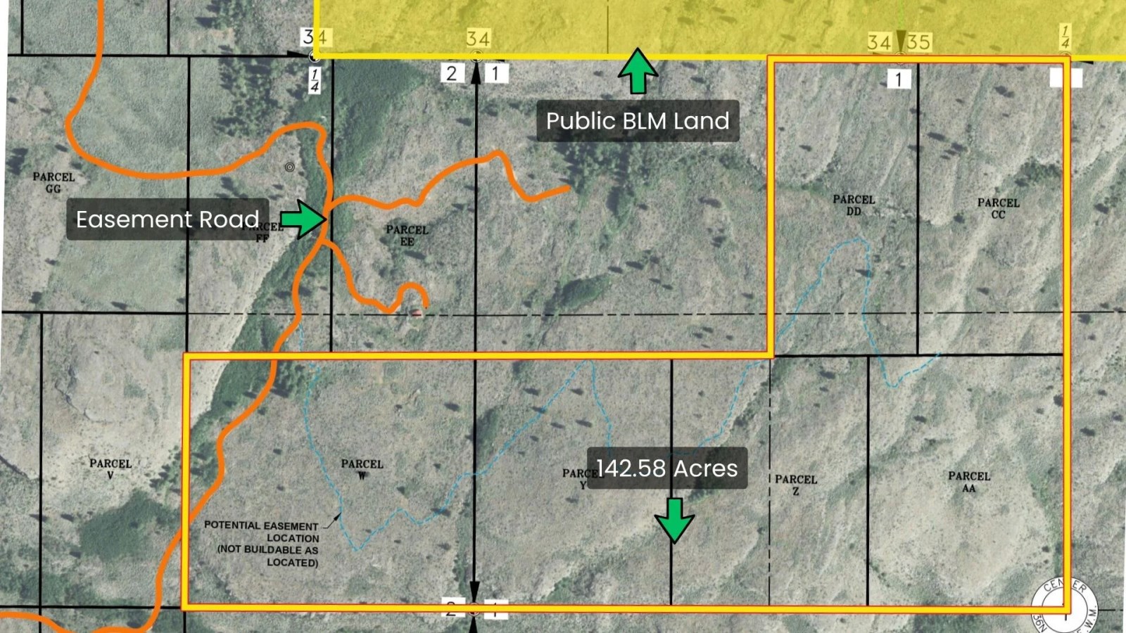
142.58 Ac Bordering 758 Acres Blm
McLaughlin Canyon Rd : Tonasket, WA 98855
Okanogan County, Washington
Ranch Description
142.58 Acres in Top WA Mule Deer Unit, Bordering 758 Acres of BLM with Direct Road Access )
Cash Price: $245,900
Owner Financing: $24,900 down, then $2,162.70 per month for 240 months (includes principal, interest and processing).
Reservation Fee: $900 non-refundable reservation fee secures this property. Reservation fee will be counted toward purchase price or down payment.
With your Purchase You Get:
1. Clean Title with a Deed in Your Name
2. Build on your Land During the Financing Period
3. Live on your Land and Run Utilities During the Financing Period
4. NO Closing Fees if you Close Directly In-House with our BBB A+ Rated Sales Team
BBB A+ Rating Business: We are Better Business Bureau Accredited Company with an A+ Gold Star Rating. We pride ourselves on giving our customers all of the history and results of our deep-dives on the properties they are interested in so that they can make the most informed purchasing decision. Our properties are hand-picked based on features that hold value. Call or Email us Today to Learn More about our streamlined buying experience.
Buyer Due Diligence: We do our best to ensure listing accuracy. However, buyer is responsible to perform their own due diligence and verify all information, contained herein or not, including access and utility accessibility and costs, and physically visit the property. Property is sold “AS Is”.
Seller Pays all Closing Costs.
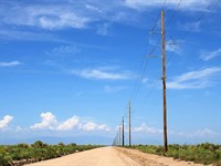
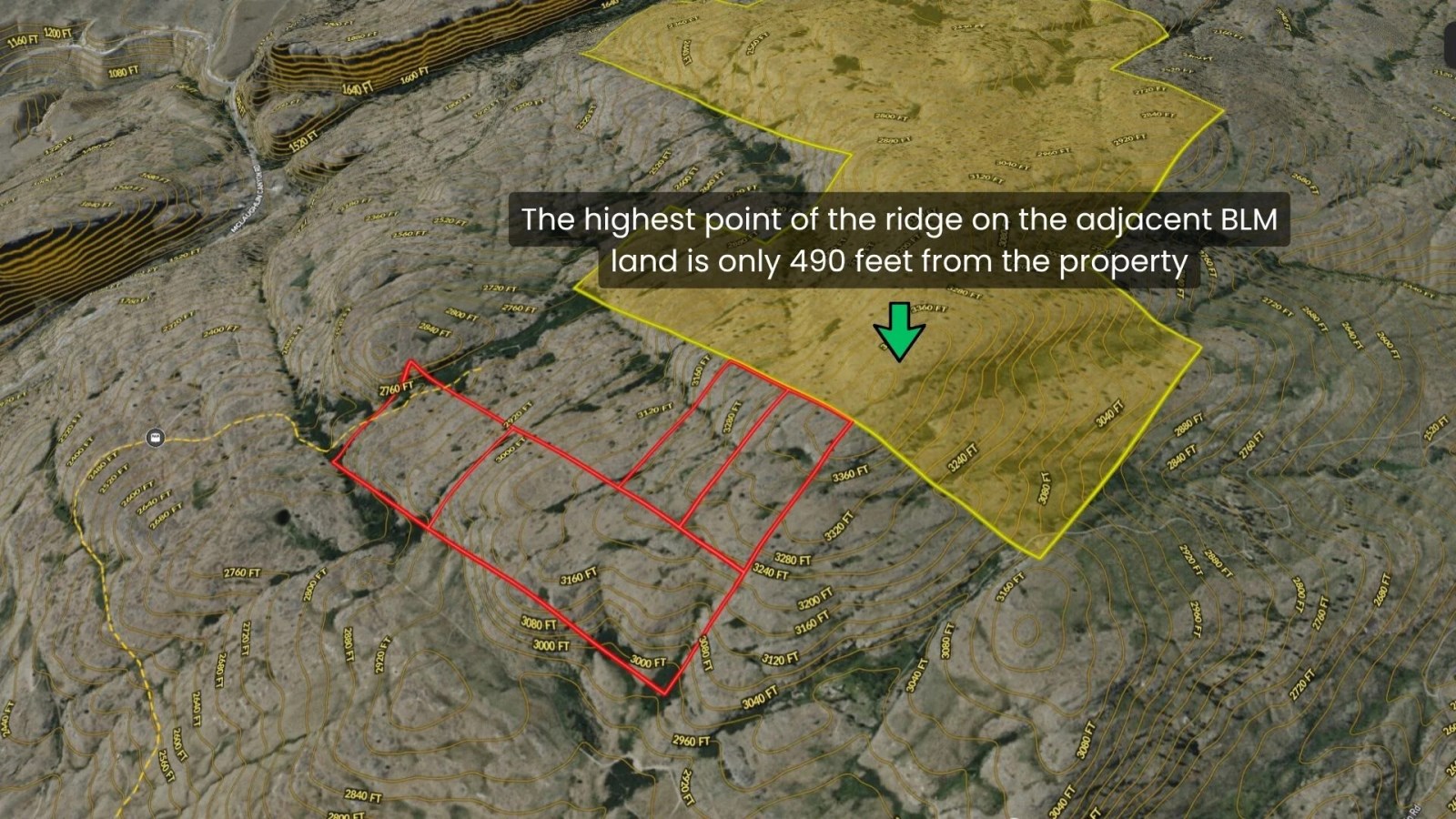
Direct Road Access & Exclusive Gateway to 758 Acres of BLM Land
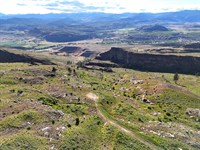
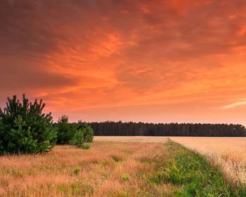
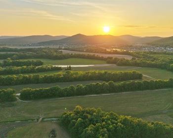
This 142.58-Acre parcel is uniquely positioned along an elevated ridgeline and offers two standout features that are rarely found together: direct road access and direct adjoining BLM access.
With frontage and access from the main road, the property serves as a direct gateway from the subdivision to approximately 758 acres of adjoining BLM land. This creates an exceptional opportunity for hunters, outdoor enthusiasts, and recreational groups seeking convenient access to large public hunting grounds without navigating through neighboring private properties.
A particularly valuable advantage is that the adjoining BLM tract is landlocked from the remainder of the subdivision, making this property the only tract that provides direct access from the subdivision to the public land. Owners can travel directly from the main road, through their property, and onto the BLM acreage, creating a seamless transition between private ownership and expansive public recreation. This unique road-to-BLM connection enhances the property's appeal for hunting, scouting, hiking, and other outdoor pursuits.ross their property,
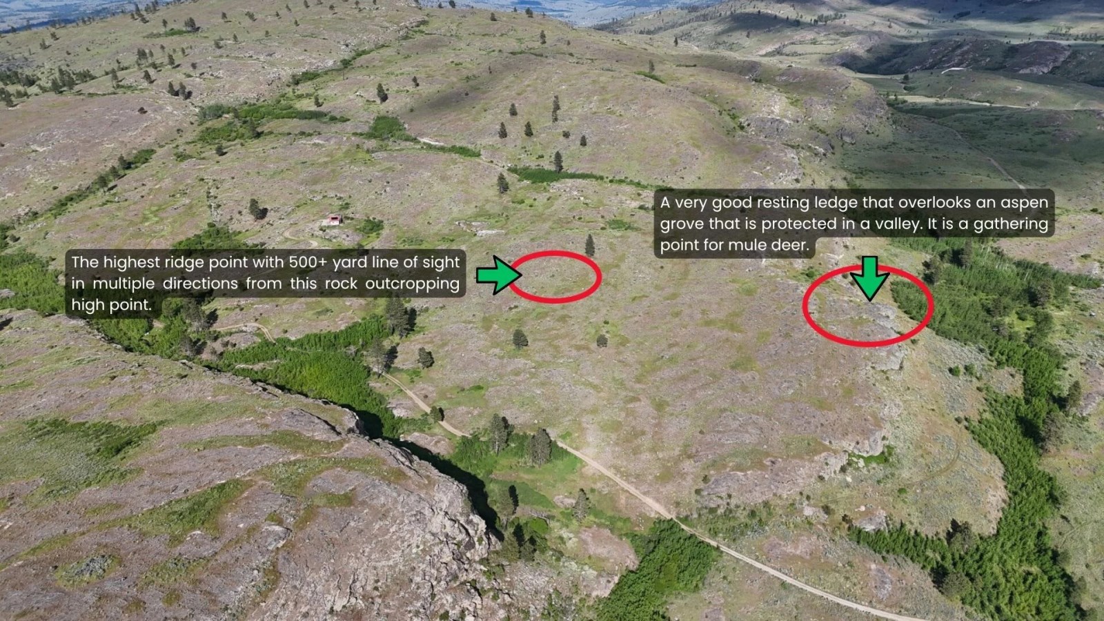
The highest point of the ridge on the adjacent BLM land is located approximately 490 feet from the property, allowing quick access to elevated glassing and scouting locations. Combined with the natural terrain, ridgeline topography, and direct public land access, the property offers excellent potential for game travel corridors, strategic hunting setups, and group hunting excursions across a much larger contiguous area than the deeded acreage alone would suggest.
Property Composition
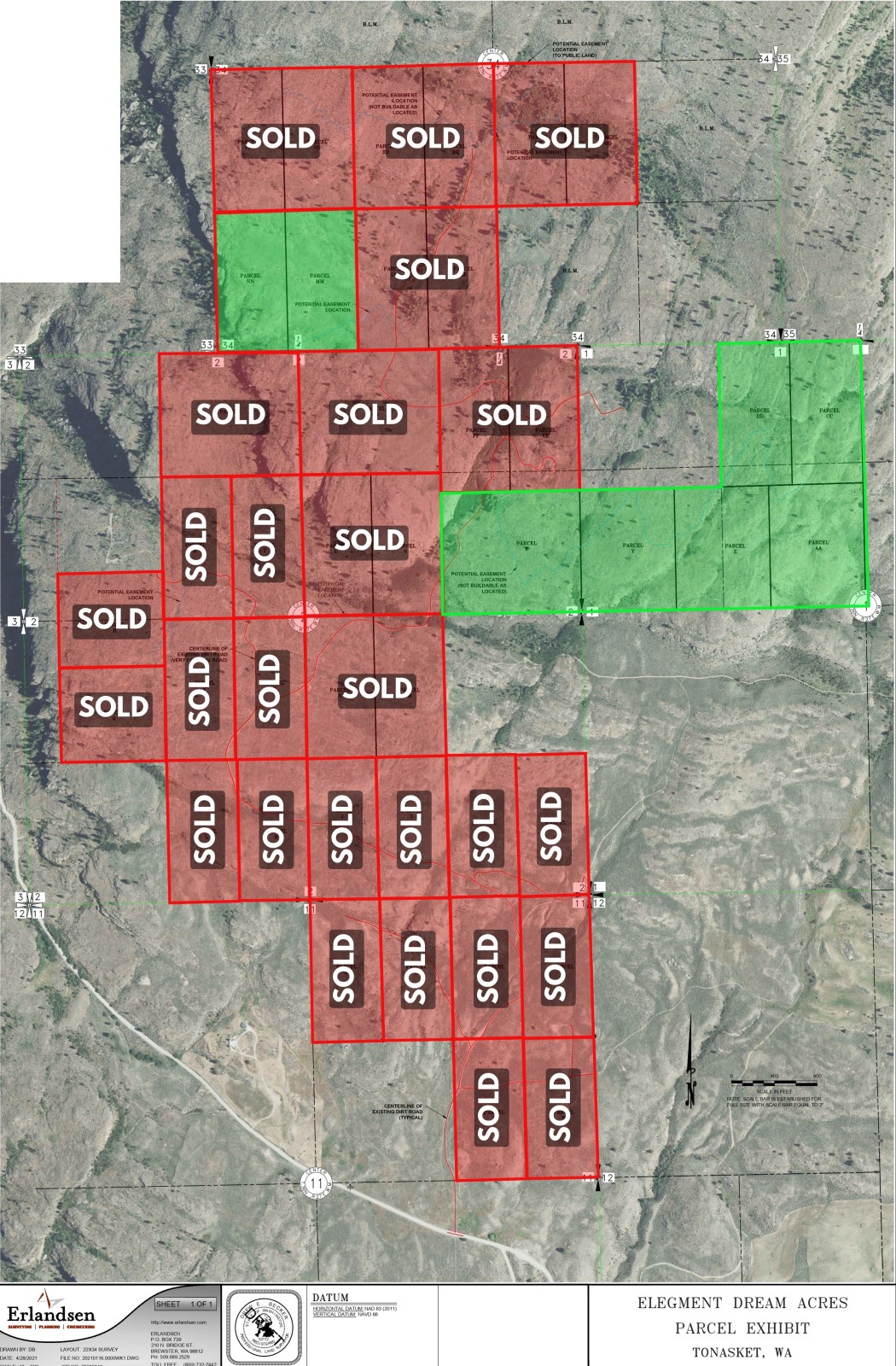
This 142.58 acres consists of four separate parcels being sold together, providing flexibility for future use, recreation, or long-term investment:
Tract W: 33.98 acres
Tracts Y, Z & AA: 68.50 acres
Tract DD: 20.05 acres
Tract CC: 20.05 acres
Together, these four parcels comprise approximately 142.58 acres of diverse terrain with direct road access and adjoining BLM frontage. The multi-parcel configuration offers potential advantages for land management, recreational planning, and future ownership strategies while maintaining a large, contiguous footprint.
Close to Town:
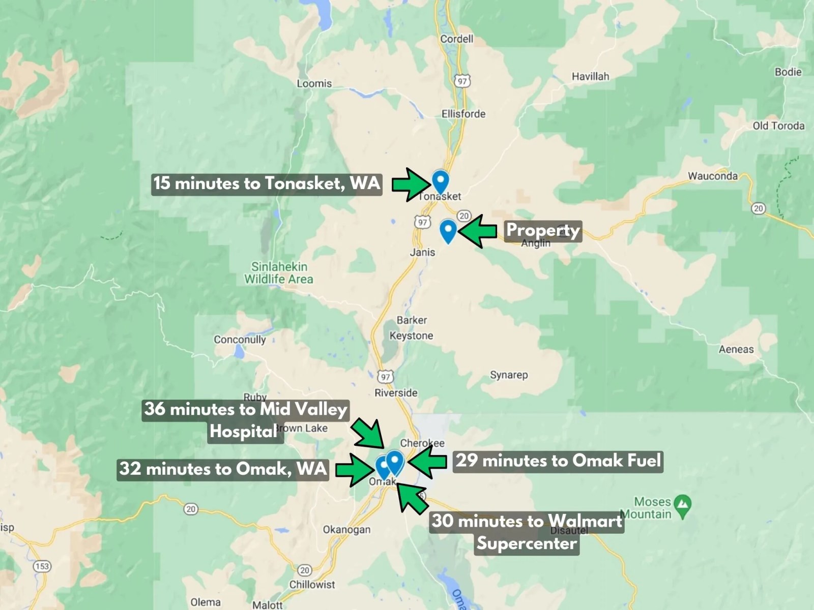
Located just 15 minutes from Tonasket, WA (great pizza, thai food, coffee, banking, hospital, school, ag stores, building supplies, shipping, and even a new cannabis shop) and 15 minutes from a top quality Deer Processor (Dick Mickey's), this property makes the perfect location for adventure, views, and close access to town.
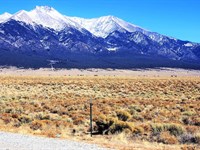
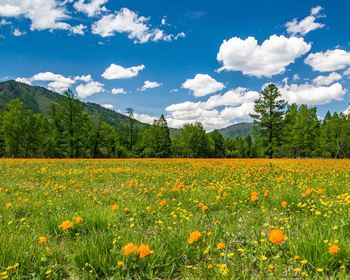
Mule Deer Heaven:
The mule deer population is outstanding. The ranch is located within Game Management Unit 204, ranked the best county in Washington State for top scoring Mule Deer. Contact us for a private viewing of our owner's trophy shots. Check out the county's hunting prospects guide here. There are also 2 seasons annually (a Spring and Fall season) for black bear.
You are within 15 minutes of custom deer processing that provides a variety of flavors, cuts and options and 30 minutes from our taxidermy friends that live on an Indian reservation.
Clean Title and Exclusive Public Land Access:
As a new owner, you will receive a warranty deed and survey for this impressive 148.52-Acre mountain property. The property directly borders 758 acres of Bureau of Land Management (Blm) land, providing a rare opportunity to enjoy both private ownership and immediate access to a vast expanse of public land. With direct access from the road to the BLM acreage through this unique group of parcels, opportunities like this are increasingly difficult to find. Whether you're looking for exceptional hunting, hiking, wildlife viewing, or a secluded recreational retreat, this property offers the freedom of owning substantial acreage while enjoying access to hundreds of additional acres of neighboring public land. Large mountain tracts with direct access to adjoining BLM land are exceptionally rare and highly sought after.
Driving Conditions:
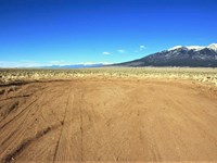
The property itself is accessible all the way up the mountain by our private road which intersects with McCaughlin Canyon Road. Check our driving directions and photos for pictures of the gate and survey. We have installed a circular turnaround pad and driveway directly onto the property where conditions are best for parking, cabin installation and a view over the town. You can drive there by 2WD during the Spring, Summer and Fall. In heavy rain seasons or Winter, we recommend 4WD just in case for seasonal mud and snow. In Heavy Snow conditions we do not recommend driving at all, use a snowmobile or walk. Sections of the road that experience the most annual wear and tear have been graveled; overall road conditions are good. The road is generally at least 6' wide all the way to the top and we have been able to successfully haul cabins and heavy trucks all the way up.
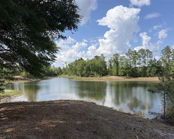
There are 2 Options for Water:
Well Drilling and Spring Water (Can be Unpredictable): Results are mixed across the entire development on the availability for well water. Currently across the 890-Acre ranch, 2 of the tracts have producing wells, another 2 have shallow water hand-dug wells, 1 tract has a dry well, and 3 remaining tracts have above-ground flowing spring-fed water. There is the possibility for addition springs to run underneath the ground but where they are and if they produce can be unpredictable. The producing wells have ranged from 180' in depth to 540' in depth. The dry well is approximately 300' deep. See well reports and producers in our land report below.
Bulk Water Storage from Tonasket (Recommended): Both the Ace Hardware store and Lee Frank Mercantile Store in Tonasket offer solutions to purchase bulk water storage containers and options for pickup and delivery. This is a very affordable and sanitary approach for seasonal recreational usage compared with drilling a new well. 325 Gallon Tanks run ($400) and 2,500 Gallon thanks run ($1,500). Water is sold at an approximate rate of $651 per 500 Gallons (subject to change).
History of McCloughlin Canyon:
Just down the street from this property, you will drive past a lookout point in the canyon where a historical marker is placed. In July 1958, a group of indians (upset by an increasing flow of miners heading for gold fields) lay in ambush through the length of the canyon. As 150 men led by David McCloughlin approached from the south, the warriors camouflaged their stone breastworks with branches. But their wilted leaves alerted McCloughlin's advance party so the Indians opened up prematurely. Firing continued for several hours near the mouth of the canyon. Three miners were killed. The caravan retreated to the Okanogan river and next day crossed over in rafts.
Ag Exemption:
100 acres land for sale in Okanogan, Washington benefits from an agricultural exemption with a small herd of cattle grazing the overall mountainside to keep the property taxes low and grass growth down to protect the land from wildfire risk.
Cell Service and Internet:
Excellent reception at the top of the mountain with good speeds from Verizon, At&T & T-Mobile enabling you to FaceTime off the bluff views. Service along the county road entrance and initial drive up the lower parts of the road is much more challenging. We recommend turning your GPS On before driving up McCaughlin Canyon road in case you temporarily lose service. Internet is best recommended through Starlink Satellite. Connection speeds reach up to 150 BPS with hardly anyone else pointing towards that satellite in this area.
Recreational Purpose:
This ranchette enjoys low but sensible restrictions, allowing numerous uses:
Yurt and Cabin Builds and Commercial Rentals
Full Time Rv
Any Permanent Structures
Tiny Homes
Camping
Basic restrictions are in place to ensure properly handling of waste and wastewater, not leaving fires unattended, hunting or shooting on or over the easement roads, maintaining easement roads, and not using tents and lean-tos / shanties as permanent residences.
Land Details:
No HOA
No Minimum building size
Water: 325 Gallon ($400) and 2,500 Gallon ($1,500) tanks available for purchase at nearby Tonasket Ace Hardware, Lee Frank Mercantile. Also sell water at $651 per 500 Gallons.
Electricity: Okanogan Public Utility District. Call for cost estimates of getting power to your property. -
Satellite internet services: Internet is best recommended through Starlink Satellite. Connection speeds reach up to 150 BPS with hardly anyone else pointing towards that satellite in this area.
Curbside Trash Service: by Upper Valley Disposal Call
Tonasket School District : Elementary, Middle School, & High School
Nearby College: Wenatchee Valley College
Elegment ID: Llp_Wa_Okanogan
Address: Lot W-Y-Z-Aa-Cc-Dd, McLaughlin Canyon Rd, Tonasket, Okanogan County, Washington, 98855
Gps: 48.64937, -119.41935
Parcel Number:,,,
Size: 142.58 Acres
Dimension: 1084 ft x 2657 ft x 1436 ft x 1345 ft x 2522 ft x 3987 ft
Title: Free & Clear, Warranty Deed
Zoning: Resource - Agriculture Current Use
Taxes: $604.4 per year
Successful Wells and Completion Dates:
Robert Thompson
Okanogan Drilling
County: Okanogan
Well Report ID: 148058, Well Tag Id:Acb607, Notice of Intent Number: W050165
Well Diameter: 6 in. , Well Depth: 540 ft.
Well Type: Water
Well Completion Date: 09-30-1996
Company: Fogle Pump and Supply
Tax Parcel Number:
County: Okanogan, Well Address: Tbd, Tonasket
Well Report ID: 1887049, Well Tag Id:Blg913, Notice of Intent Number: We33384
Well Diameter: 6 in. , Well Depth: 180 ft.
Well Type: Water
Well Completion Date: 11-15-2018, Well Report Received Date: 12-13-2018
Nearby Cities & Points of Interest
We've put together a complete google list of activities for your convenience: [Click Here]
15 Minutes to Tonasket, Wa
30 minutes to Walmart Supercenter
30 minutes to Omak City
32 minutes to Wenatchee Valley College North
36 minutes to Sinlaheken Wildlife Area
37 minutes to Okanogan Valley Golf Club
38 minutes to Conconully Lake
38 minutes to Lake Osoyoos and Canadian Border
40 minutes to Bannon Mountain Trailhead
44 minutes to Omak Lake
48 minutes to Fourth of July Trailhead
1 hour to Loup Ski Bowl
1 hour 43 minutes to North Cascades Heli Skiing
3 hours 10 minutes to Spokane, WA & GEG International Airport
Ranch Maps & Attachments
Directions to Ranch
How to visit this 142.58 acres lot for sale in Okanogan, Washington?
To visit this 142.58 acres land for sale in Okanogan Washington, search Lot W-Y-Z-AA-CC-DD, McLaughlin Canyon Rd, Tonasket, Washington, 98855 within Okanogan County on any mapping app. When you are near the land, search “48.64937, -119.41935“ on mapping app to locate one of the corners.
Gate Entrance to private road / easement: 48.632084, -119.419994
Northwest Corner: 48.65028, -119.42012
Southwest Corner: 48.64727, -119.42009
Southeast Corner: 48.64739, -119.40354
Northeast Corner: 48.6543, -119.40349
North Corner: 48.65428, -119.40908
More Ranch Details
Ranch Price History
More Ranches from Andrew Finger
 40 AC : $84.9K
- 25.1 AC : $33.9K
- 42.4 AC : $320K
- 19.1 AC : $25.9K
- 38.6 AC : $49.9K
- 35.8 AC : $44.9K
- 22 AC : $160K
- 10.3 AC : $95K